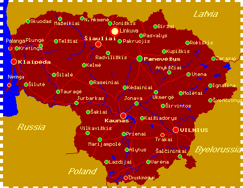
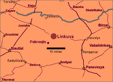
LINKUVA 56�05'00"N 023�59'00"E. Village in Northern Lithuania on the banks of the Musa River. 25 miles (40 km) northeast of SIAULIAI (SHAVLI), the nearest large town. LITHUANIA is bounded by Latvia, Byelorussia, Poland and the Baltic Sea. In 1939 after some territorial exchanges the population of Lithuania was just under 3,000,000 of which about 270,000 (9%) were Jews. Only about 6000 Jews survived the Holocaust. From August 1940 it was a component of the USSR. It regained independence shortly before disintegration of the USSR.

 "Only two things are infinite, the universe and human stupidity, and I'm not sure about the former." - Albert Einstein (1879-1955)